
Map of Islands of the Pacific, 1795 – Framed Print
$149 – $319
Description
Description
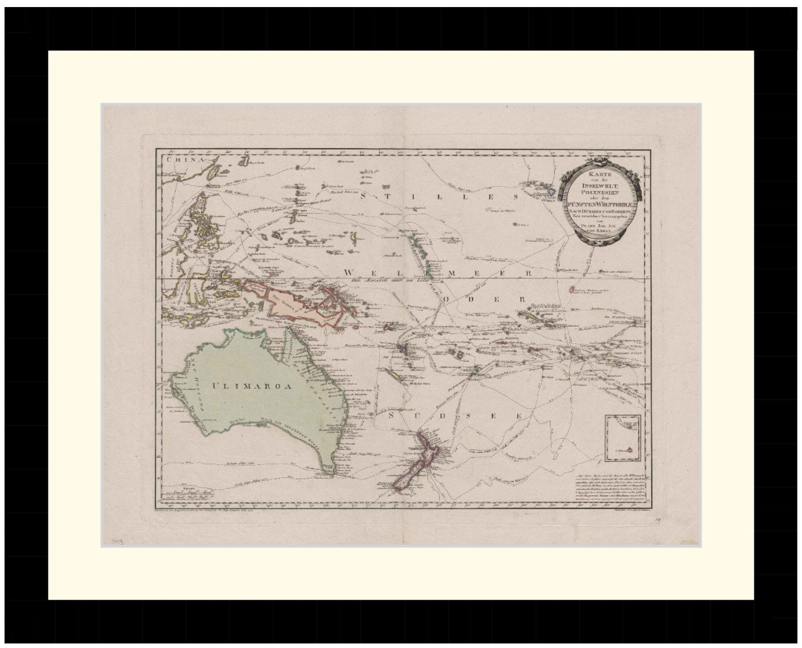
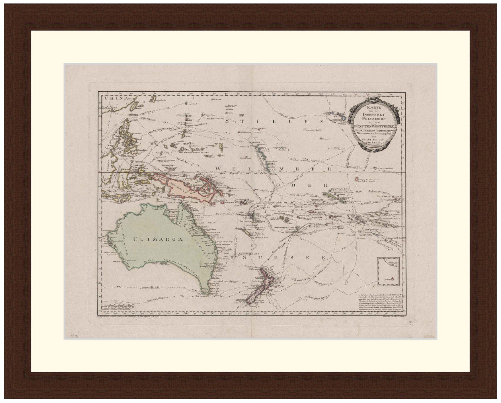
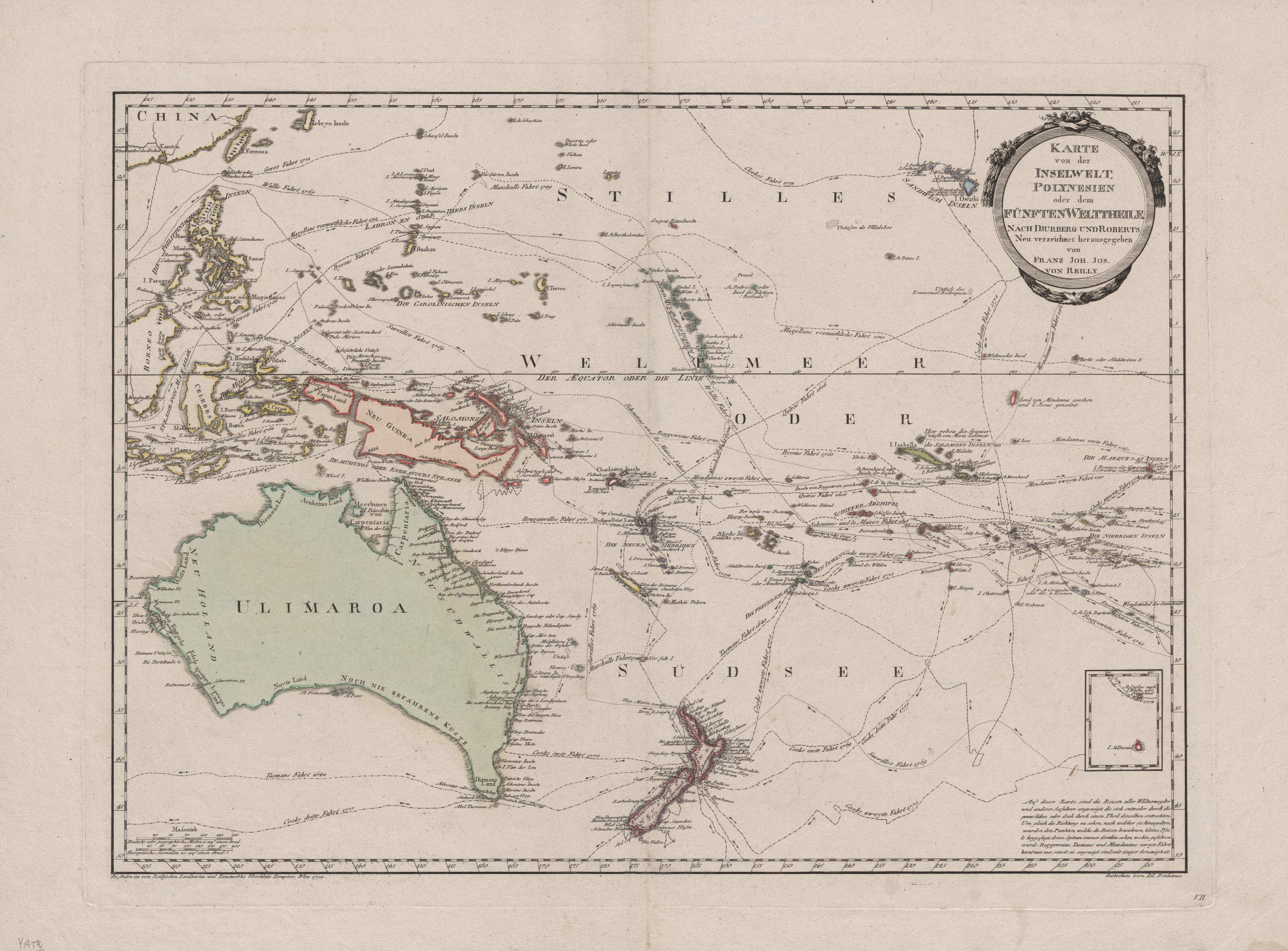
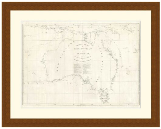
Map of Australia and South West Pacific, showing tracks of many explorers from 1520 including Magellan. Drawn by Franz J. J. von Reilly, 1795.
Tasmania shown joined to Australian mainland, Australia called ‘Ulimaroa’, Papua New Guinea shown as two islands. Place names in English and German.
Available in 3 sizes:
- Small 36.1cm x 29cm
- Medium 49.6cm x 39cm
- Large 70cm x 54cm
Available in 3 Frame Types, Black, Dark Brown Wood and Light Brown Wood.
High quality framing with Non-Reflective glass. Printed on Ilford GALERIE Prestige Fine Art paper. 10 to 15 day turnaround for framing, but let us know if you need it by a particular date and we will try our best to make it happen.
Other sizes and frames available, email hello@historyguild.org for more. The sale of these prints funds our history education programs, thank you for your support.
Additional Info
Additional information
| Size | Small, Medium, Large |
|---|---|
| Frame | Black Frame, Dark Brown Wood Frame, Light Brown Wood Frame |