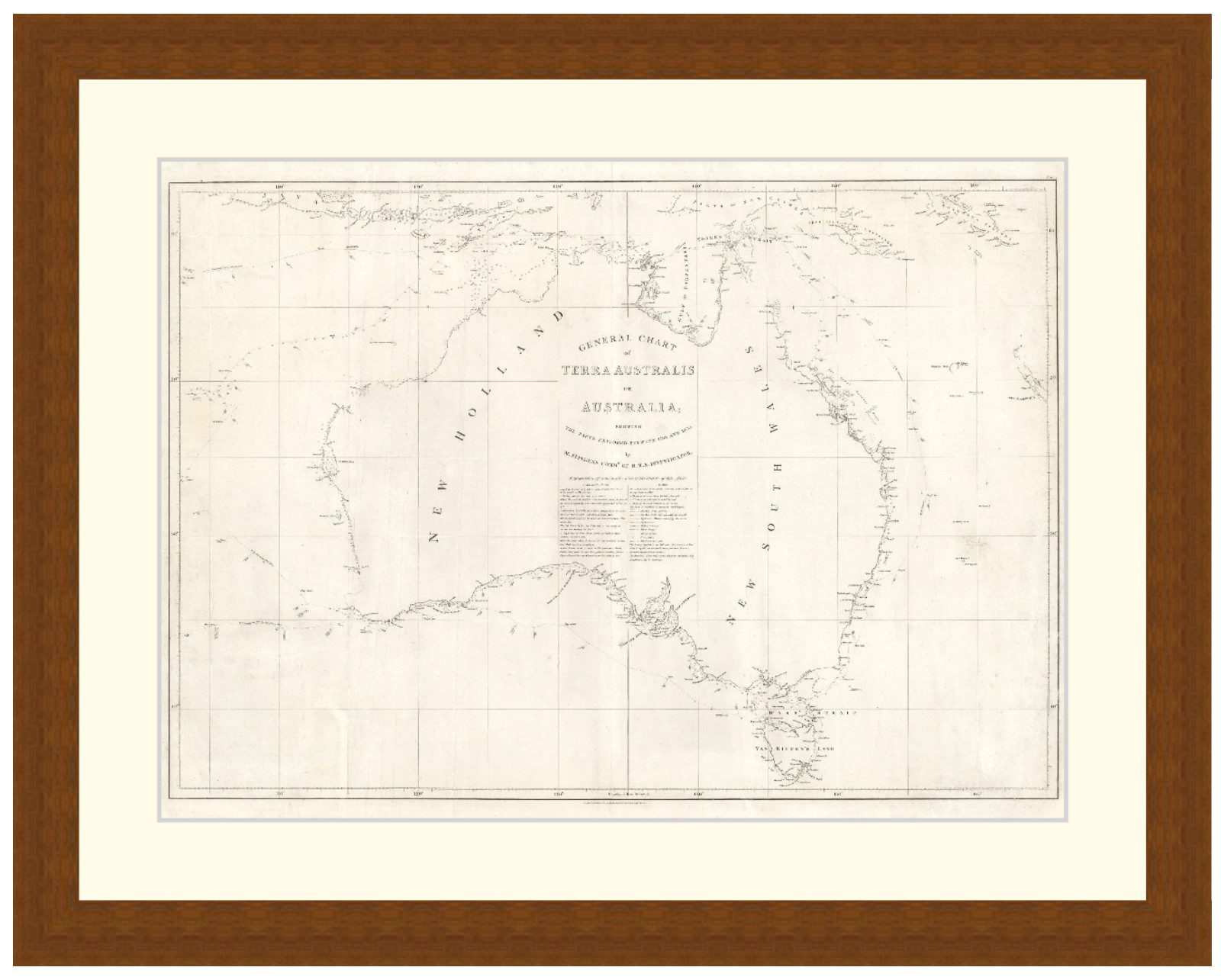
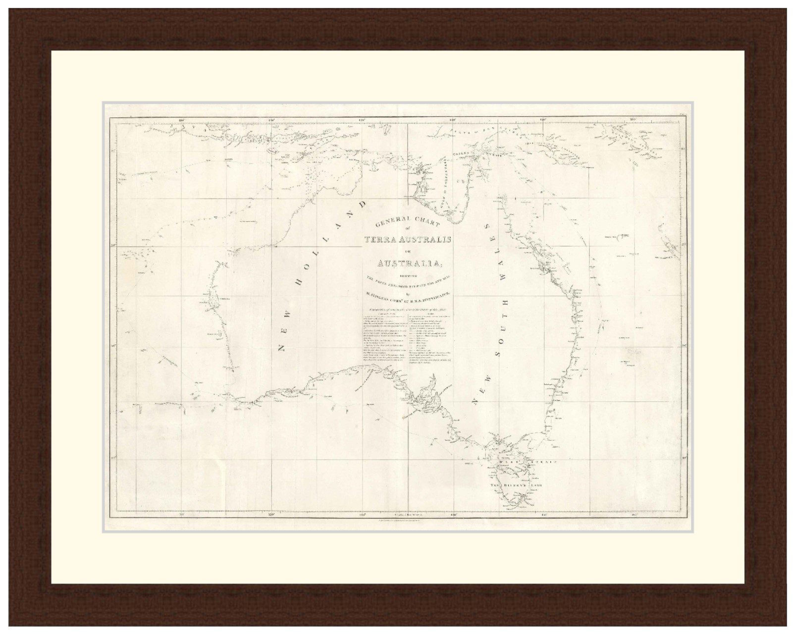

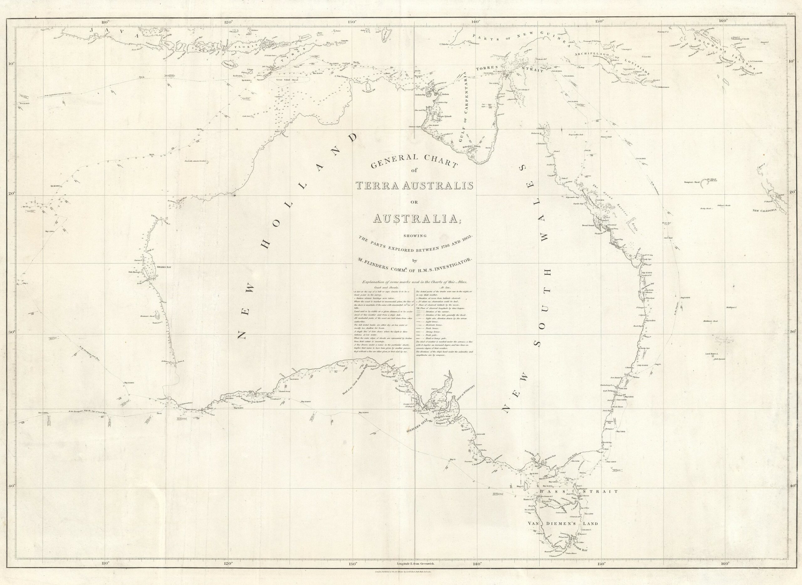
General chart of Terra Australis or Australia, 1814 – Framed Print
Price range: $149 through $319
Description
Description
First highly accurate map of Australia, shows the entire Australian coastline in detail. Drawn by Matthew Flinders, published by G. & W. Nicol.
Available in 3 sizes:
- Small 36.4cm x 29cm
- Medium 50.1cm x 39cm
- Large 70.7cm x 56cm
Available in 3 Frame Types, Black, Dark Brown Wood and Light Brown Wood.
High quality framing with Non-Reflective glass. Printed on Ilford GALERIE Prestige Fine Art paper. 10 to 15 day turnaround for framing, but let us know if you need it by a particular date and we will try our best to make it happen.
Other sizes and frames available, email hello@historyguild.org for more. The sale of these prints funds our history education programs, thank you for your support.
Additional Info
Additional information
| Size | Small, Medium, Large |
|---|---|
| Frame | Black Frame, Dark Brown Wood Frame, Light Brown Wood Frame |