


Map of Australia, 1807 – Framed Print
$149 – $319
Description
Description
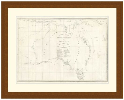
Map of Australia, the East Indies, New Guinea and the islands of the western Pacific showing tracks of D’Entrecasteaux’s ships, Recherche and Esperance in 1792-1793. Published 1807.
Coastline of southeastern Australia and northern and western Tasmania is missing as it had not yet been surveyed by the French.
Available in 3 sizes:
- Small 38.7cm x 29cm
- Medium 53.6cm x 39cm
- Large 75.9cm x 54cm
Available in 3 Frame Types, Black, Dark Brown Wood and Light Brown Wood.
High quality framing with Non-Reflective glass. Printed on Ilford GALERIE Prestige Fine Art paper. 10 to 15 day turnaround for framing, but let us know if you need it by a particular date and we will try our best to make it happen.
Other sizes and frames available, email hello@historyguild.org for more. The sale of these prints funds our history education programs, thank you for your support.
Additional Info
Additional information
| Size | Small, Medium, Large |
|---|---|
| Frame | Black Frame, Dark Brown Wood Frame, Light Brown Wood Frame |