

Imperial Airways Map of the World, 1937 – Framed Print
Price range: $149 through $319
Description
Description
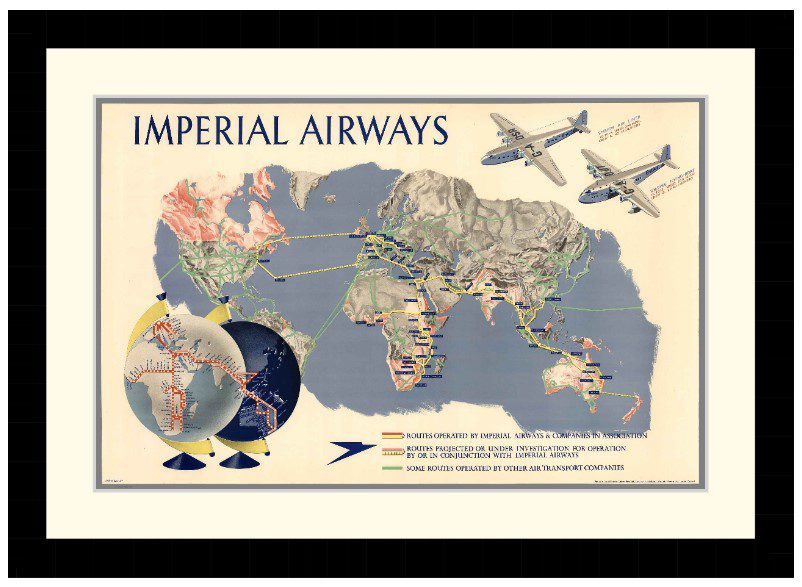
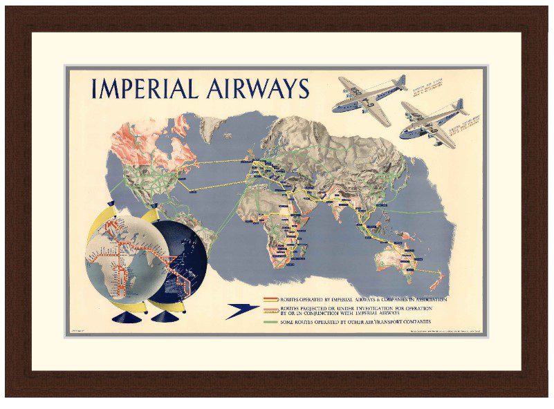
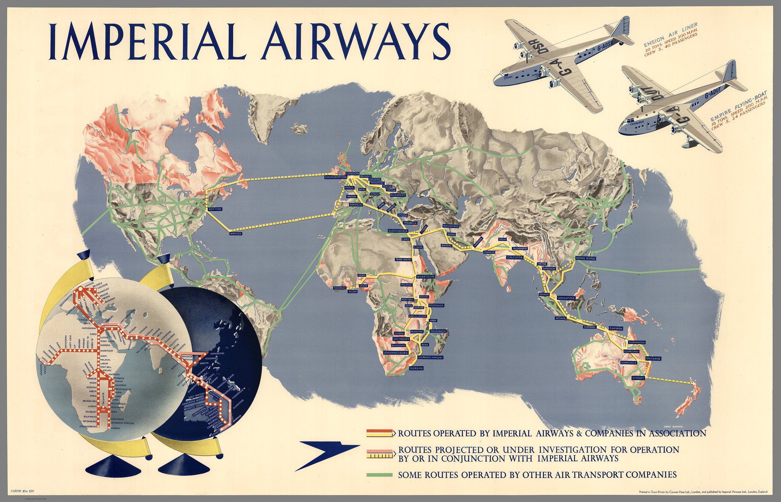
Describes routes operated by Imperial and other airways, with views of British Empire with the luxurious Imperial Airways sea-planes. Imperial Airways was the early British commercial long range air transport company, operating from 1924 to 1939 and serving parts of Europe but principally the Empire routes to South Africa, India and the Far East, including Malaya and Hong Kong. Illustrated by James Gardner.
Available in 3 sizes:
- Small 40.1cm x 29cm
- Medium 55.7cm x 39cm
- Large 79.1cm x 56cm
Available in 3 Frame Types, Black, Dark Brown Wood and Light Brown Wood.
High quality framing with Non-Reflective glass. Printed on Ilford GALERIE Prestige Fine Art paper. 10 to 15 day turnaround for framing, but let us know if you need it by a particular date and we will try our best to make it happen.
Other sizes and frames available, email hello@historyguild.org for more. The sale of these prints funds our history education programs, thank you for your support.
Additional Info
Additional information
| Size | Small, Medium, Large |
|---|---|
| Frame | Black Frame, Dark Brown Wood Frame, Light Brown Wood Frame |

